Overview
Overview of the Maps Module
The Maps module uses SQL queries to construct dynamic maps that make data more tangible and easier to interpret.
Access the Maps Page
Procedure
- In the module navigation menu, select
.
The Maps page appears.
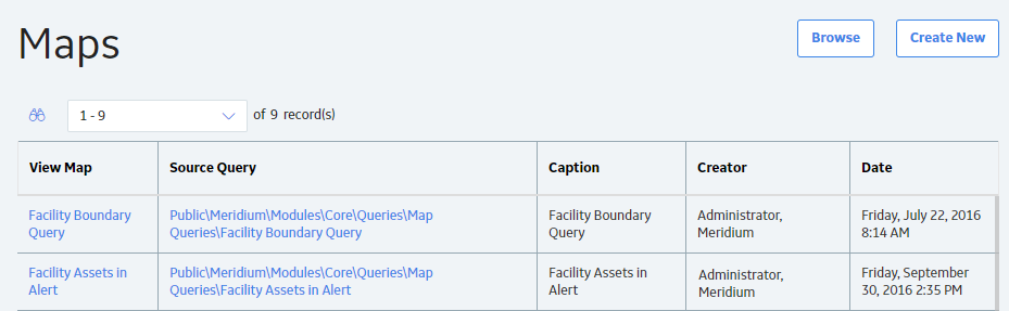
The Maps page contains the following items:
- Browse: This allows you to select a preexisting query from the catalog.
- Create New: This allows you to create a query using the Design or SQL workspace.
-
 : This allows you to search preexisting queries.
 - View Map: This grid column contains the names of the existing Map queries. Select the name of the query whose visual map you want to view.
- Source Query: This grid column contains the filepaths of each stored query. Select a hyperlink to access the Results workspace for that query.
Map Query Workflow
This workflow provides the basic, high-level steps for using this module. The steps and links in this workflow do not reference every possible procedure. For more procedures, see the links in the Related Information section.
- >Use the GIS Data Loader to load your geospatial data into GE Digital APM
- Modify the Baseline Map Query
The baseline Map query is highly customizable, and more complex queries can be created using the following additional steps:
You can also use the following type of SQL query to further customize your map and the data displayed on it.